Sorry, we will be closed for maintenance from Nov 14th, 2014 to Mar 3rd, 2015. Wishing you a Merry Christmas and a Happy New Year 2015. Manager Gary Kamloops Guesthouse
Chichén Itzá is the largest of the archaeological cities of the pre-Columbian Maya civilization in the Yucatan Peninsula of Mexico. It is one of Mexico's most visited tourist destinations. It was granted World Heritage Site status in 1988 by UNESCO World Heritage Site and was recently selected as one of the New Seven Wonders of the World.
(Picture taken by Gary, KGH).
Juarez Street is one of the few through streets on the surface. It is filled with various stores and restaurants and has a constant flow of both people and traffic.
The other through streets of town are either partially or fully underground, following the old drainage ditches and tunnels dug during colonial times. Originally they were used for flood control, but modern dams have controlled flooding and left them dry, so they have been turned into thoroughfares in a city with little surface area.
The most important of these roads is Miguel Hidalgo or Belaunzarán, which carried the runoff from the river that used to divide the city in two. Guanajuato’s version of the La Llorona story has the woman wandering the tunnels of the city, some of which had rivers or streams running through them.
Here you can ease your tensions and soothe tired muscles by relaxing in one of Escondido Place’s pools of steaming, mineral-rich waters along the road to Atotonilco.
The landscape is traditional; with picnic areas and snack bars, family-friendly; where kids enjoy play areas, and you can enjoy spa services and full restaurants.
Escondido has amazing gardens and ten pools with water temperature up to 104F. Escondido has both indoors pool and outdoor pools where you can relax under the open sky or sheltered by rock-lined grottos.
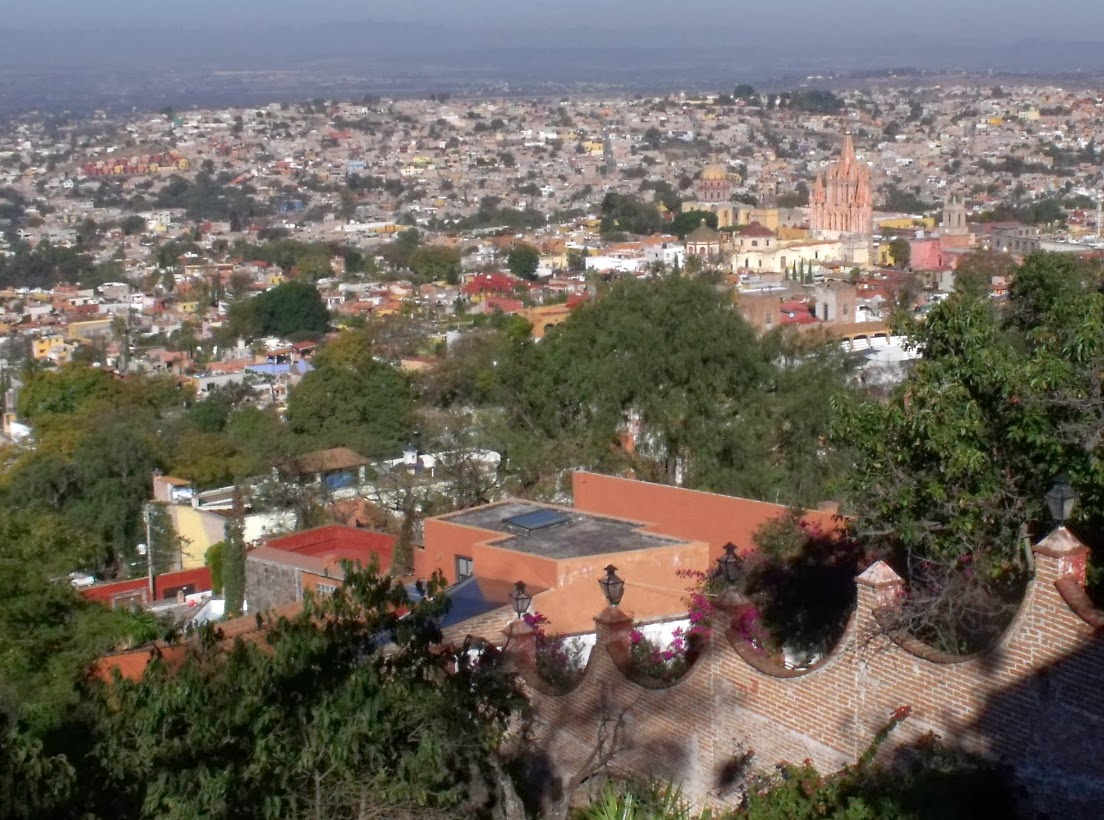
The Mirador is a lookout point which offers the best view of the San Miguel de Allende. It is on the southeast side of town. You can get here on foot. The sightseeing trolleys that depart several times a day from the Jardín stop by here.
The sightseeing trolleys that depart several times a day from the Jardín stop by here. There is a handicrafts market and a cafe here, so you can have some refreshment while you enjoy the wonderful view.
The oldest part of San Miguel de Allende is the El Chorro neighborhood. This is where the village of San Miguel was moved to in 1555. The Nahuatl name for the area was Izcuinapan or “place of dogs,” and according to legend, dogs led Juan de San Miguel to this area to find this spring.
This area is the home of the Parish of San Miguel, the Jardin Principal or Main Garden and an earlier church called the San Rafael or Santa Escuela Church
In San Miguelde Allende, Next to the cultural center is the Inmaculada Concepcion Church, locally known as Las Monjas (The Nuns). It was originally constructed as part of the convent. The church was constructed between 1755 and 1842 with an elegant cupola added by Zeferino Gutierrez in 1891, inspired by the Les Invalides Church in Paris.
The cupola is octagonal decorated with Corinthian columns in the lower area and the upper area has a window with a balustrade and statues of saints. Topping the cupola is a lantern window with a statue depicting the Immaculate Conception. Inside, there are paintings by Juan Rodriguez Juarez.
The most prominent feature of the city is its enormous aqueduct, consisting of seventy five arches, each twenty meters wide with a total extension of 1,280 meters and an average height of twenty three meters.
It was built by the Marquis Juan Antonio de la Urrutia y Arana between 1726 and 1738 at the request of the nuns of the Santa Clara Convent to bring water to the residents of the city from La Cañada.
Peña de Bernal (in English: Bernal's Boulder or Bernal Peak) At 433 m (1,421 ft) it is one of the tallest monoliths in the world. Other tall monoliths include the Rock of Gibraltar and Sugarloaf Mountain. (Mount Augustus, in Western Australia, is sometimes credited to be the world's second largest monolith.
According to Leonor López Domínguez of México Desconocido, the porphyrytic monolith was formed some 100 million years ago during the Jurassic period, when it must have been at least three times higher than today.
A recent chemical analysis by researchers at the National Autonomous University of Mexico has determined that it is much younger—likely formed about 8.7 million years ago.
The convent of this church, known as Las Monjas, was founded by Josefa Lina de la Canal y Hervas (1736-1770), the first-born of Manuel Tomas de la Canal (1701-1749).
From the very first day of the convent’s foundation to the inauguration of the actual structure, Maria Josefa de la Canal worked arduously to sustain the project that she herself created—both in terms of financing and religious pursuits. Maria Josefa passed away five years after the official opening, on August 9, 1770.
Initiated in 1755, the new convent took ten years to build, and upon completion, the nuns moved into their new home to commemorate the occasion on December 28, 1765. The church, however, remained unfinished, including the main towers, the bell tower and altars, which were completed during the first half of the 19th century.
Another important component that remained missing was the dome, and talented mason Zeferino Gutiérrez (also author of the Parroquia’s neo-Gothic façade) was called on to do the job. Assisted by the great Mexican artist popularly known as Dr. Atl, Gutiérrez found inspiration in the monumental church of Les Invalides in Paris.
Cesare Cardini (February 24, 1896 – November 3, 1956) was an Italian American restaurateur, chef, and hotel owner, who is credited with creating the Caesar salad.
After having worked in European gastronomy, Caesar went to the United States in his early 20s. He ran a restaurant in Sacramento, then he moved to San Diego where he was in the restaurant business. At the same time he engaged in the same business in Tijuana, where he could avoid the restrictions of prohibition.
Cardini is credited with having created "Caesar's salad" which became fashionable among Hollywood and other celebrities, especially after he had moved his restaurant a few blocks to the hotel built c. 1929 (nowadays called Hotel Caesar's).
The park grounds were once full of plentiful orchards and vegetable plots thanks to the water coming down from El Chorro. Dr. Hernández Macías wanted San Miguel residents to have a place for recreation, and also wanted to create a "lung" for the city, and so over a period of 9 years, from 1895 to 1904, he bought the orchards one by one and put them together to create this park, an extraodinarily beautiful sight when it opened 100 years ago.
Specially chosen trees grew lush, pruned cedars and acacias graced the two original entrances on Diez de Sollano and Aldama (fomerly Calle de Hospital), lawns were dotted with calla lilies, and sculpted hedges lined the interior paths. The park also had two large cisterns, which would supply water in case El Chorro ran dry.
Where today we see basketball courts was once a field full of sunflowers, with an impressive fountain in the middle. Though that fountain is gone, other fountains have been preserved. These all have low walls, letting us see reflections on the water.
One of the Morelia downtown highlights is the baroque cathedral with its surrounding plazas: the Plaza de Armas. The cathedral is enormous, covering more than 2 city blocks in area. Architectural details like the flying buttresses and tiled cupolas give it a distinctive look.
The Cathederal is the site for the local “Day of the Dead” celebration in early November. It is more of an experience than can be described here. Most of the activities take place after dark and especially on the weekend.
Volcán de Parícutin is a cinder cone volcano in the Mexican state of Michoacán, close to a lava-covered village of the same name. The volcano is unique in the fact that its evolution from creation to extinction was witnessed, observed and studied. It appears on many versions of the Seven Natural Wonders of the World.
Volcán de Parícutin erupted and the lava buried 2 villages. Finally the lave reached and flew over the graves around San Juan Parangaricutiro Church. But leaving the church tower and altar untouched.
Veracruz, officially known as Heroica Veracruz, is a major port city and municipality on the Gulf of Mexico in the Mexican state of Veracruz. The city is located in the central part of the state, 90 km (56 mi) from the state capital Xalapa.
Veracruz is Mexico’s oldest, largest, and historically most significant port since European colonization.
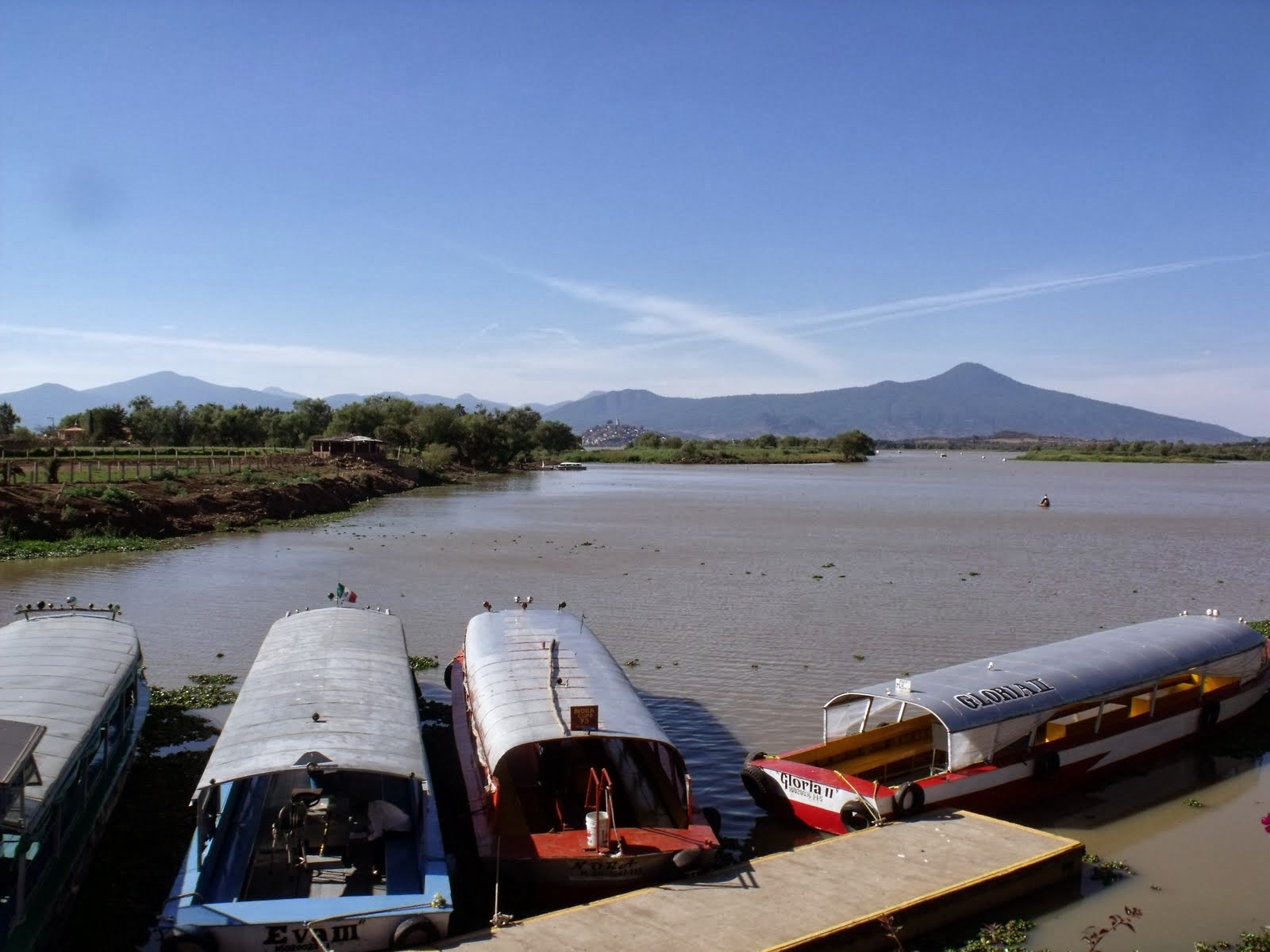
The Lake Pátzcuaro basin is home to the P'urhépecha people. It is the heartland of the Tarascan state, which rivaled the Aztec Empire before the Spanish conquest.
The natives believe that the lake is the place where the barrier between life and death is the thinnest.
Lake Atitlán is a fairly large lake for the elevation (1,562 m) in the Guatemala highlands. It is technically endorheic (lacking direct flow to the sea) but substantial seepage feeds two nearby rivers.
Atitlan is recognized to be the deepest lake in Central America with maximum depth about 340 metres (1,120 ft). The lake is shaped by deep escarpments which surround it and by three volcanoes on its southern flank. The lake is about 50 kilometres (31 mi) west-northwest of Antigua.
The lake basin is volcanic in origin, filling an enormous caldera formed in an eruption 84,000 years ago.
The area supports extensive coffee and avocado orchards and a variety of farm crops. The lake itself is rich in animal life which provides a significant food source for the largely indigenous population.
Tijuana is the largest city on the Baja California Peninsula. An industrial and financial center of Mexico. As the city has become a leading center in the country, so has the surrounding metropolitan area, a major industrial and paramount metropolis in northwestern Mexico. Currently one of the fastest growing metropolitan areas in Mexico.
The city is the most visited border city in the globe; sharing an approximate 24-kilometre-long border (15 mi) with its sister city San Diego, over fifty million people annually cross the border between these two cities.
This metropolitan crossing makes the San Ysidro Port of Entry the busiest land-border crossing in the world. It is estimated that the two border crossing stations between the cities proper of San Diego and Tijuana account for 300,000 daily border crossings alone.
Comitán is the fourth-largest city in the Mexican state of Chiapas. It is located in the east-central part of Chiapas, near the border with Guatemala . The population is around 90,000 people.
Comitán is also a popular tourist destination, mostly for Mexican nationals, though some foreign visitors can also be seen. The town itself is one of the most pleasant and pretty in Mexico, with colonial architecture, narrow avenues, and clean streets.
The climate is cool most of the year, and can get quite chilly from October to March. The town square is active almost every night, with live music, or some kind of presentation.
Parque Natural del Flamenco Mexicano (also known as the "Celestun Biosphere Reserve") is a wetland reserve that is the winter home to vast flocks of flamingos, as well as many herons and other bird species. This location is set within the Petenes mangroves ecoregion. In addition, more than 200 species of birds pass through on migration, or live there.
Chichen Itza was a center of pilgrimage for the ancient Maya for over 1,000 years. The Sacred Cenote (a large natural well or limestone sink hole) was holy to the ancient Rain God "Chac".
About 987 the ruler of the Toltec people of central Mexico came here, and with his Maya allies made Chichen Itza the most powerful city in the Yucatan. The ruler called himself "Kukulcan", the name of the Mesoamerican Feathered Serpent deity and Chichen Itza became a center for worship of that god as well. More buildings were built here in a mixture of Maya and Toltec styles.
Ría Lagartos Biosphere Reserve is located in the Eastern end of the coastal strip of the Yucatán Peninsula, with the Gulf of Mexico at its Northern limit. The area encompasses coastal areas of the Gulf of Mexico and includes important wetlands designated under the Ramsar Wetlands Convention.
El Árbol del Tule (Spanish for The Tree of Tule) is a tree located in Santa María del Tule in the Mexican state of Oaxaca, approximately 9 km east of the city of Oaxaca on the road to Mitla. It has the stoutest trunk of any tree in the world. Its trunk had a circumference of 42.0 m (137.8 ft), equating to a diameter of 14.05 m (46.1 ft). The height is 35.4 m (116 ft). DNA tests have proven that it is only one tree. The age is ranging between 1,200 and 3,000 years. Informatin source : Wiki